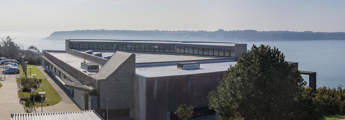
Image and Instrumentation Pole (P2I)
P2I is a transverse platform of the IUEM that aims to facilitate research, training and observation missions by pooling scientific equipment and expertise and services in imaging and instrumentation in marine and coastal sciences.
The activities concern :
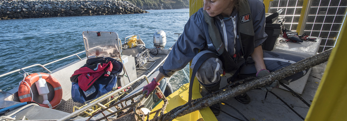
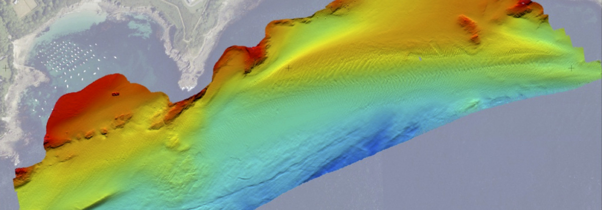
• The interdisciplinary use of remote sensing and marine instrumentation
• The coordination of equipment projects
• Shared management of equipment
• Methodological research
• Training in data acquisition, processing and analysis
• Expertise for instrumental qualification and data validation.
Since 2020, P2I has been involved in a quality approach in collaboration with the DT-INSU and the IRD (IMAGO unit) to guarantee and maintain the performance of equipment and ensure the quality and traceability of data.


P2I functional organization chart
IUEM Directorate
Image and Instrumentation Pole
Coordination : Marion Jaud and Peggy Rimmelin-Maury
Scientific referents : Christophe Delacourt and Anne Lebourges-Dhaussy
Expertise contacts :
Imaging and methodological development: Marion Jaud
Instrumentation and sensor verification: Peggy Rimmelin-Maury
Quality assurance: Emilie Grossteffan


LEMAR
LETG
LGO
LOPS
IUEM Joint Service Unit
Publications
- Jaud M., Bertin S., Beauverger M., Augereau E., Delacourt C. (2020). RTK GNSS-Assisted Terrestrial SfM Photogrammetry without GCP: Application to Coastal Morphodynamics Monitoring. Remote sensing, 12(11), 1889. https://doi.org/10.3390/rs12111889
- Letortu P., Jaud M., Théry C., Nabucet J., Taouki R., Passot S., Augereau E., (2020). The Potential of Pleiades images with high-angle of incidence for monitoring Norman cliff face erosion. International Journal of Applied Earth Observations and Geoinformation, 84, 101976. https://doi.org/10.1016/j.jag.2019.101976
- Jaud M., Kervot, M., Delacourt C., Bertin S. (2019). Potential of Smartphone SfM photogrammetry to measure coastal morphodynamics. Remote Sensing, 11, 2242. https://doi.org/10.3390/rs11192242
- Jaud M., Delacourt C., Le Dantec N., Allemand P., Ammann J., Grandjean P., Nouaille H., Prunier C., Cuq V., Augereau E., Cocquempot L., Floc’h F, 2019. Diachronic UAV photogrammetry of a sandy beach in Brittany (France) for a long-term coastal observatory. ISPRS International Journal of Geo-Information, 8(6), 267; https://doi.org/10.3390/ijgi8060267
- Jaud M., Letortu P., Théry C., Grandjean P., Costa S., Maquaire O., Davidson R., Le Dantec N., 2019. UAV survey of a coastal cliff face – Selection of the best imaging angle. Measurement. 139, 10-20. https://doi.org/10.1016/j.measurement.2019.02.024
- Jaud M., Passot S., Allemand P., Le Dantec N., Grandjean P., Delacourt C., 2019. Suggestions to Limit Geometric Distortions in the Reconstruction of Linear Coastal Landforms by SfM Photogrammetry with PhotoScan® and MicMac® for UAV Surveys with Restricted GCPs Pattern. Drones, 3(1), 2.
- Jaud M., Le Dantec N., Ammann J., Grandjean P., Constantin D., Akhtman Y., Barbieux K., Allemand P., Delacourt C., Merminod B., 2018. Direct georeferencing of a push-broom, light-weight hyperspectral system for mini-UAV applications. Remote Sensing, 10(2), 204.
- Letortu P., Jaud M., Grandjean P., Ammann J., Costa, S., Maquaire O., Davidson R., Le Dantec N., Delacourt C., 2018. Guidelines for high resolution survey methods for monitoring cliff erosion at an operational scale: Application to coastal chalk cliffs in Normandy (France). GISciences & Remote Sensing, 55(4), 1-20.
- Jaud M., Letortu P., Augereau E., et al., 2017. Adequacy of pseudo-direct georeferencing of terrestrial laser scanning data for coastal landscape surveying against indirect georeferencing. European Journal of Remote Sensing, 50(1), 155-165.
- Mahabot M-M., Jaud M., Pennober G., Le Dantec N., Troadec R., Suanez S., Delacourt C., 2017. Toward a shoreline evolution observatory in tropical environments: the case of back-reef beaches in La Réunion Island. Comptes Rendus Geoscience, 349, 330-340.
- Fromant G., Floc’h F., Lebourges-Dhaussy A., Jourdin F., Perrot Y., Le Dantec N. and Delacourt C., (2017), In situ quantification of the suspended load of estuarine aggregates from multifrequency acoustic inversion, Journal of Atmospheric and Oceanic Technology, v. 34, p. 1625–1643, doi: 10.1175/JTECH-D-16-0079.1
- Le Bivic, R.; Allemand, P.; Quiquerez, A.; Delacourt, C. Potential and Limitation of SPOT-5 Ortho-Image Correlation to Investigate the Cinematics of Landslides: The Example of “Mare à Poule d’Eau” (Réunion, France). Remote Sens. 2017, 9, 106.
- Jaud M., Passot S., Le Bivic R., Le Dantec N., Delacourt C., 2016. Assessing the Accuracy of High Resolution Digital Surface Models Computed by PhotoScan® and MicMac® in Sub-Optimal Survey Conditions. Remote Sensing, 8(6).
- Jaud M., Grassot F., Le Dantec N., Verney R., et al., 2016. Potential of UAVs for Monitoring Mudflats Morphodynamics (Application to the Seine estuary, France). International Journal of Geo-Information, 5(4).
Pôle Spectrométrie Océan
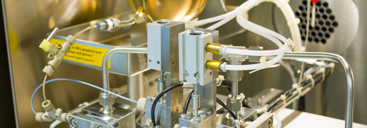
Pôle Spectrométrie Océan (PSO)
PSO concerns an innovative mass spectrometry devices package enabling trace chemical elements and isotopes analysis in geological and biological natural samples. The project associates UBO (IUEM), CNRS, Ifremer and IRD through complementary devices sharing specific to each organisation and devices acquired in common. PSO is a structuring tool for oceanographic research in the field of chemistry, biology and marine geochemistry carried out within the framework of the topics developed in IUEM laboratories through axes 3, 4 and 6 of LabexMER and EUR ISblue.
Devices located at IUEM are as follows: