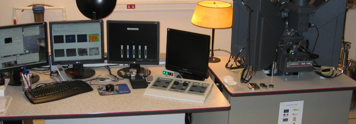
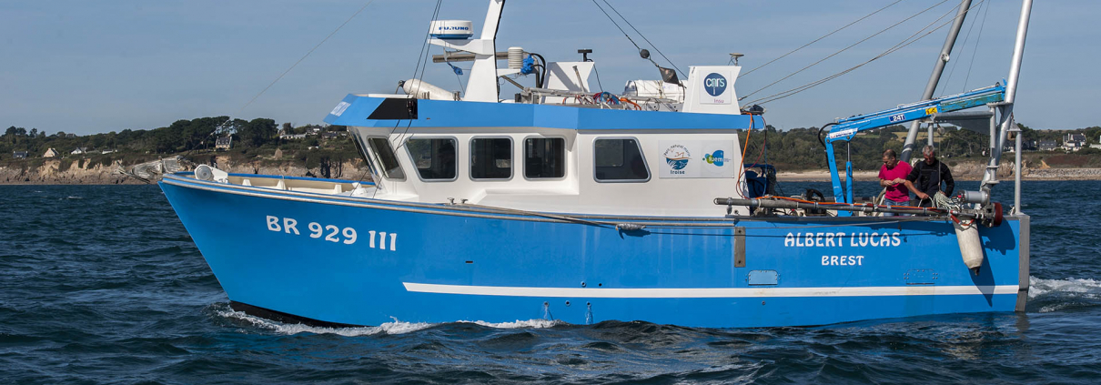
Pôle Image et Instrumentation (P2I)
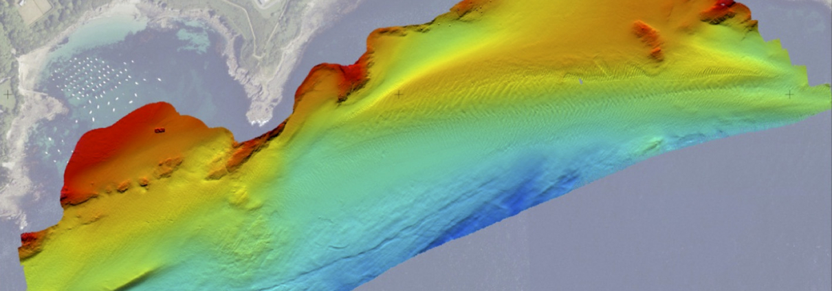
Plateforme transverse de l’IUEM, le P2I vise à faciliter les missions de recherche, formation et observation en mutualisant les équipements scientifiques et les expertises et services en imagerie et instrumentation en sciences de la mer & du littoral.
Les activités concernent :
- l’utilisation interdisciplinaire de la télédétection et de l’instrumentation marine
- la coordination des projets d’équipements
- la gestion mutualisée des équipements
- la recherche méthodologique
- la formation sur l’acquisition, le traitement et l’analyse de données
- l’expertise pour la qualification instrumentale et la validation de données.
Depuis 2020, le P2I s’est inscrit dans une démarche qualité en collaboration avec la DT-INSU et l’IRD (unité IMAGO) pour garantir et maintenir la performance des équipements et assurer la qualité et la traçabilité des données.


Organigramme fonctionnel du P2I
Direction de l’IUEM
Pôle Image et Instrumentation
Coordination : Marion Jaud et Peggy Rimmelin-Maury
Référents scientifiques : Christophe Delacourt et Anne Lebourges-Dhaussy
Contacts expertises :
Imagerie et développement méthodologiques : Marion Jaud
Instrumentation et vérification de capteurs : Peggy Rimmelin-Maury
Assurance qualité : Emilie Grossteffan


LEMAR
LETG
LGO
LOPS
Unité Mixte de Service de l’IUEM
Publications
- Jaud M., Bertin S., Beauverger M., Augereau E., Delacourt C. (2020). RTK GNSS-Assisted Terrestrial SfM Photogrammetry without GCP: Application to Coastal Morphodynamics Monitoring. Remote sensing, 12(11), 1889. https://doi.org/10.3390/rs12111889
- Letortu P., Jaud M., Théry C., Nabucet J., Taouki R., Passot S., Augereau E., (2020). The Potential of Pleiades images with high-angle of incidence for monitoring Norman cliff face erosion. International Journal of Applied Earth Observations and Geoinformation, 84, 101976. https://doi.org/10.1016/j.jag.2019.101976
- Jaud M., Kervot, M., Delacourt C., Bertin S. (2019). Potential of Smartphone SfM photogrammetry to measure coastal morphodynamics. Remote Sensing, 11, 2242. https://doi.org/10.3390/rs11192242
- Jaud M., Delacourt C., Le Dantec N., Allemand P., Ammann J., Grandjean P., Nouaille H., Prunier C., Cuq V., Augereau E., Cocquempot L., Floc’h F, 2019. Diachronic UAV photogrammetry of a sandy beach in Brittany (France) for a long-term coastal observatory. ISPRS International Journal of Geo-Information, 8(6), 267; https://doi.org/10.3390/ijgi8060267
- Jaud M., Letortu P., Théry C., Grandjean P., Costa S., Maquaire O., Davidson R., Le Dantec N., 2019. UAV survey of a coastal cliff face – Selection of the best imaging angle. Measurement. 139, 10-20. https://doi.org/10.1016/j.measurement.2019.02.024
- Jaud M., Passot S., Allemand P., Le Dantec N., Grandjean P., Delacourt C., 2019. Suggestions to Limit Geometric Distortions in the Reconstruction of Linear Coastal Landforms by SfM Photogrammetry with PhotoScan® and MicMac® for UAV Surveys with Restricted GCPs Pattern. Drones, 3(1), 2.
- Jaud M., Le Dantec N., Ammann J., Grandjean P., Constantin D., Akhtman Y., Barbieux K., Allemand P., Delacourt C., Merminod B., 2018. Direct georeferencing of a push-broom, light-weight hyperspectral system for mini-UAV applications. Remote Sensing, 10(2), 204.
- Letortu P., Jaud M., Grandjean P., Ammann J., Costa, S., Maquaire O., Davidson R., Le Dantec N., Delacourt C., 2018. Guidelines for high resolution survey methods for monitoring cliff erosion at an operational scale: Application to coastal chalk cliffs in Normandy (France). GISciences & Remote Sensing, 55(4), 1-20.
- Jaud M., Letortu P., Augereau E., et al., 2017. Adequacy of pseudo-direct georeferencing of terrestrial laser scanning data for coastal landscape surveying against indirect georeferencing. European Journal of Remote Sensing, 50(1), 155-165.
- Mahabot M-M., Jaud M., Pennober G., Le Dantec N., Troadec R., Suanez S., Delacourt C., 2017. Toward a shoreline evolution observatory in tropical environments: the case of back-reef beaches in La Réunion Island. Comptes Rendus Geoscience, 349, 330-340.
- Fromant G., Floc’h F., Lebourges-Dhaussy A., Jourdin F., Perrot Y., Le Dantec N. and Delacourt C., (2017), In situ quantification of the suspended load of estuarine aggregates from multifrequency acoustic inversion, Journal of Atmospheric and Oceanic Technology, v. 34, p. 1625–1643, doi: 10.1175/JTECH-D-16-0079.1
- Le Bivic, R.; Allemand, P.; Quiquerez, A.; Delacourt, C. Potential and Limitation of SPOT-5 Ortho-Image Correlation to Investigate the Cinematics of Landslides: The Example of “Mare à Poule d’Eau” (Réunion, France). Remote Sens. 2017, 9, 106.
- Jaud M., Passot S., Le Bivic R., Le Dantec N., Delacourt C., 2016. Assessing the Accuracy of High Resolution Digital Surface Models Computed by PhotoScan® and MicMac® in Sub-Optimal Survey Conditions. Remote Sensing, 8(6).
- Jaud M., Grassot F., Le Dantec N., Verney R., et al., 2016. Potential of UAVs for Monitoring Mudflats Morphodynamics (Application to the Seine estuary, France). International Journal of Geo-Information, 5(4).
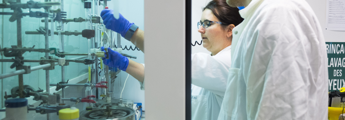
Pôle Spectrométrie Océan (PSO)
Pôle spectrométrie océan (PSO)
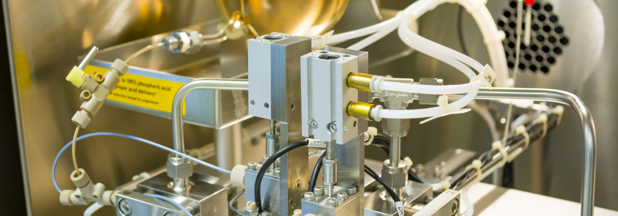
Le PSO concerne un ensemble dʼéquipements innovants de spectrométrie de masse permettant lʼanalyse des éléments chimiques en traces et des isotopes dans les échantillons naturels dʼorigine géologique et biologique. Le projet associe lʼUBO (IUEM), le CNRS, Ifremer et lʼIRD par la mutualisation dʼéquipements complémentaires propres à chaque organisme et dʼéquipements acquis en commun.
Le PSO est un outil structurant pour les recherches océanographiques touchant au domaine de la chimie, de la biologie et de la géochimie marine menées dans le cadre des thématiques développées dans les laboratoires de lʼIUEM et à travers les axes 3, 4 et 6 du LabexMER et de l’EUR ISblue.
Les équipements localisés à l’IUEM sont les suivants :


 S.Hervé / UBO