Tag Archive for: marine spatial planning

Paddle project Final Conference

,

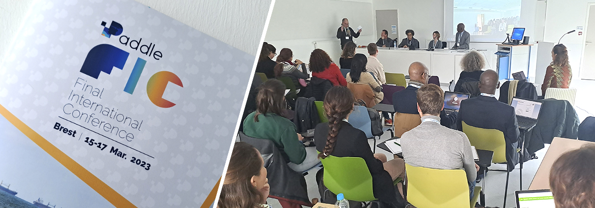
Started in 2017, the European Paddle programme, an interdisciplinary project on marine spatial planning and coordinated by Marie Bonnin (LEMAR), is holding its final conference in Brest (IUEM / PNBI) from 15 to 17 March.

During these three days, participants of several nationalities will address different themes related to marine spatial planning in the tropics, ranging from artisanal fisheries to social and cultural dimensions, including various topics such as decision support tools or marine protected areas.

The presence of researchers from different countries and disciplines is an opportunity to review marine spatial planning development projects along the coasts of the tropical Atlantic. In addition, marine spatial planning actors such as the Regional Coastal and Marine Partnership (RPMP) and the Abidjan Convention are associated with this event and represented at the conference. The different sessions allow participants to have an overview of the different sectors of activity and types of research concerned by this growing theme.

This conference is also an opportunity for all the partners to take stock of their exchanges after a 6-year project, rich in scientific and human encounters. An exhibition of photographs and videos made during the project is also proposed to the participants.
 

Spatial distribution of tropical fish assemblages

Sea bottom

Comprehensive spatial distribution of tropical fish assemblages from multifrequency acoustics and video fulfils the island mass effect framework.

Describing fish distribution and associated environmental features is the first step toward understanding how fish communities are spatially structured and is a necessary step to conduct Marine Spatial Planning (MSP) and operate relevant protection policies.

Abstract

Tropical marine ecosystems are highly biodiverse and provide resources for small-scale fisheries and tourism. However, precise information on fish spatial distribution is lacking, which limits our ability to reconcile exploitation and conservation. We combined acoustics to video observations to provide a comprehensive description of fish distribution in a typical tropical environment, the Fernando de Noronha Archipelago (FNA) off Northeast Brazil. We identified and classified all acoustic echoes into ten fish assemblage and two triggerfish species. This opened up the possibility to relate the different spatial patterns to a series of environmental factors and the level of protection. We provide the first biomass estimation of the black triggerfish Melichthys niger, a key tropical player. By comparing the effects of euphotic and mesophotic reefs we show that more than the depth, the most important feature is the topography with the shelf-break as the most important hotspot. We also complete the portrait of the island mass effect revealing a clear spatial dissymmetry regarding fish distribution. Indeed, while primary productivity is higher downstream, fish concentrate upstream. The comprehensive fish distribution provided by our approach is directly usable to implement scientific-grounded Marine Spatial Planning..

Synthetic representation of the island mass effect as illustrated by the case of Fernando de Noronha.

Synthetic representation of the island mass effect as illustrated by the case of Fernando de Noronha.

Reference

Salvetat, J., Bez, N., Habasque, J., Lebourges-Dhaussy, A., Lopes, C., Roudaut, G., Simier, M., Travassos, P., Vargas, G., and Bertrand, A. 2022. Comprehensive spatial distribution of tropical fish assemblages from multifrequency acoustics and video fulfils the island mass effect framework. Scientific Reports 12(1): 8787. Nature Portfolio, Berlin. doi:10.1038/s41598-022-12409-9.